-
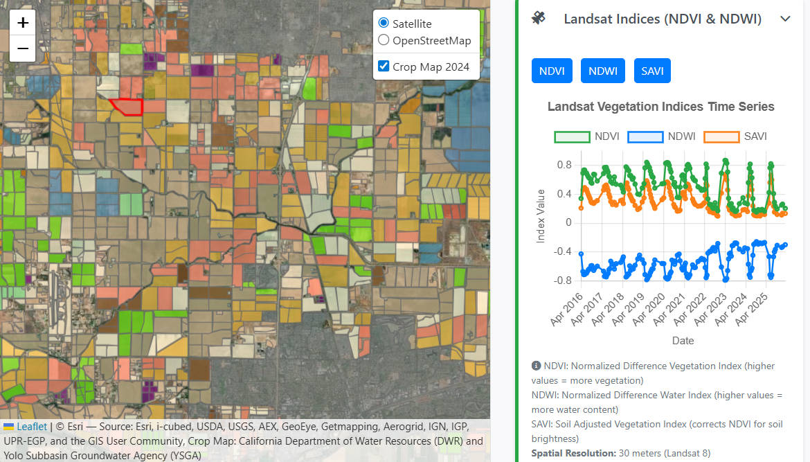
The food we grow is thirsty
Growing our food consumes plenty of water – globally 70% of human uses of water. Choices in what food we eat have tremdous impact on our planet’s land and water resources, and on our human health. Growing one kg of rice takes 3 to 10 times the amount of water compared to 1 kg of
-
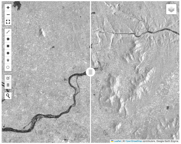
Monitoring the flooding of wetlands using Radar
Here is another application of the use of Sentinel-1 satellite radar imagery. This application estimates the intermittent flooding up of managed wetlands in the Yolo Bypass Wildlife Area. In my work on the Groundwater Sustainability Plan, one of the more uncertain elements of the water budget is the water management on managed wetlands. Managed wetlands
-
Radar imagery for mapping inundated areas
Radar imagery provides a convenient way to map inundated areas, because of it’s ability to penetrate cloud cover. Below, try the application to check out inundated areas for some of the major floods of 2024, for example. The default application centers on the town Malavalli in South India. Between July 30th and August 1st 2024,