Here is another application of the use of Sentinel-1 satellite radar imagery. This application estimates the intermittent flooding up of managed wetlands in the Yolo Bypass Wildlife Area. In my work on the Groundwater Sustainability Plan, one of the more uncertain elements of the water budget is the water management on managed wetlands. Managed wetlands are owned and operated by several different configurations of public and private agencies, such as the California Department of Fish and Wildlife, federal NRCS, local conservation groups, land owners and contracted land and water managers/service. There is certainly no centralized information on how and when different wetland complexes are watered, to what depth, and from which water source.
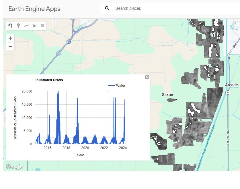
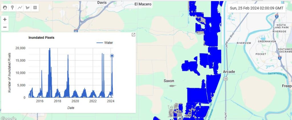
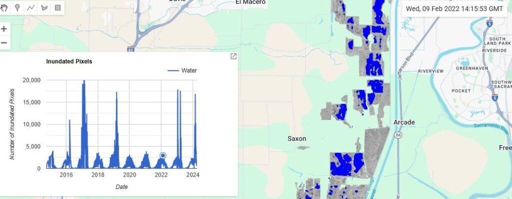
This example below extracts a 10-year, sub-monthly time series of inundation in the Yolo Bypass Wildlife Area. Note: It might take up to a minute for the graph to load. Once it loads, click on any date on the graph and the application will update to show the estimated inundated area (in blue).